The University of Tennessee GK-12 Earth Project focuses on bringing the excitement of research and discovery to rural middle school science classes in east Tennessee. Far too commonly, science is presented in elementary and secondary classrooms as a body of arcane knowledge handed down by inaccessible, distant authorities known as scientists, rather than as a process of investigation and discovery that is fun and exciting and that makes a scientist of anyone who participates.
Here we describe some of the science activities that we are carrying out to involve rural middle school students in authentic research and discovery and to link science instruction to the graduate research of GK-12 Fellows, other research at the University of Tennessee, and broader initiatives such as the Integrated Ocean Drilling Program.
We also describe here research that Teacher-Partners are conducting in the field and lab with Fellows and Faculty as part of our GK-12 project. These first-hand research experiences are strengthening the science background of our Teacher-Partners and preparing them to offer more inquiry-based activities in their classrooms.
 This inquiry-based activity provides students with an opportunity to analyze actual samples of fossil matrix (matrix is the paleontological term for the material a fossil is found in) from around a mastodon skeleton found in New York State. The Mastodon Matrix project was developed by the Paleontological Research Institution in Ithaca, New York, in collaboration with Cornell University. We are pleased to be working with the Paleontological Research Institution in our University of Tennessee GK-12 Earth Project. The mastodon died about 12,000 years ago, when the last great continental glacier that covered parts of North America was melting. Students are able to sort through the matrix to find ancient shells, bones, pieces of plants, and rocks from the time when the mastodon lived and died. The students’ discoveries will be sent back to the Paleontological Research Institution,, where they will be cataloged and further analyzed by paleontologists to help scientists form a true picture of the ecology and environment where—and when—the mastodon lived and died.
- Mastodon Matrix Instructions (MS Word file)
- Mastodon Matrix Instructions (PDF file)
The following PowerPoint presentation accompanies the lab activity and introduces students to the project, the mastodons themselves, and the Paleontological Research Institution.
Mastodon Matrix Lab PowerPoint
By Chris Underwood, Saskia van de Gevel, and other Fellows in the University of Tennessee GK-12 Earth Project
The following PowerPoint presentation, prepared for the 2006 Tennessee Science Teachers Association annual conference, further illustrates the Mastodon Matrix Project, provides a brief virtual tour of the Paleontological Research Institution and the accompanying Museum of the Earth, and discusses how the Mastodon Matrix project can be used to help fulfill some Tennessee state middle school curriculum requirements.
Looking Back in Time: The Mastodon Matrix Project
By Kristin T. Rearden, Daniel B. Lewis, Chris A. Underwood, and Sally P. Horn
For more information on the Paleontological Research Institution’s Mastodon Matrix Project, and contact information for obtaining samples to use the project in your classroom, please visit their web site.
Trees, with their annual rings, provide one of the richest troves of information about past droughts, floods, fires, freezes, and much, much more. We all know how to count rings to see how old a tree is. This in-class exercise introduces students to simple techniques that take tree-ring analysis from being a casual pastime and make it into a true science. Students examine a tree-ring record (provided as a graphic), make their own inferences, and compare it with a record of precipitation.
- Tree-Ring Activity (MS Word file)
- Tree-Ring Activity (PDF File)
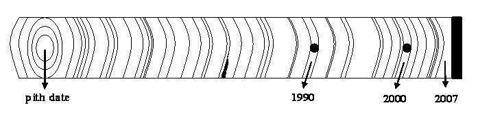
Our GK-12 students have enjoyed examining actual tree-ring samples in conjunction with this exercise. We use samples from our research projects in the Laboratory of Tree-Ring Science, and other samples prepared in our lab for demonstration purposes. School teachers wishing to do this exercise might check with science departments at local Universities, to see if samples might be available. Another option would be to contact a local tree-cutting company, to ask if the company might provide a few tree cross-sections for classroom use. Images of tree cross-sections showing growth rings are also available on many web sites.
This outdoor activity helps students grasp a little of the true scale of our Solar System. Using an ordinary basketball for the sun, it provides exact distances from the sun to each planet, and realistic sizes (exact dimensions plus something the right size, like “head of a pin” for Earth). Other information is posted at each planet (which are mounted on dowels inserted in the ground), and students complete the exercise by visiting each planet. The planets can be set up either all-in-a-row or else more realistically at different positions in their individual orbits around the sun, depending on the space available. As many planets can be included as can fit in your schoolyard!
- Solar System Scale Lab (MS Word file)
- Solar System Scale Lab (PDF file)
- Solar System Scale Lab Questions (MS Word file)
- Solar System Scale Lab Questions (PDF file)
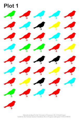
An example of the plot data for avian counts found in the biodiversity exercise.
Biodiversity and the conservation of biodiversity have received increased attention during the last few decades and these topics are included in G7–12 science curricula. Dr. Justin Hart prepared and tested an exercise on biodiversity using avian counts in forests and along forest edges as a GK-12 Fellow in Ms. Marian White’s classes at Seymour Middle School.
Click the link below for an article Justin published in the Journal of Natural Resources and Life Sciences that describes the activity.
Justin L. Hart, 2007. Biodiversity and Edge Effects: An Activity in Landscape Ecology. Journal of Natural Resources and Life Sciences Education 36: 103–106.
Plot data and a worksheet to accompany the exercise can be accessed using the links below.
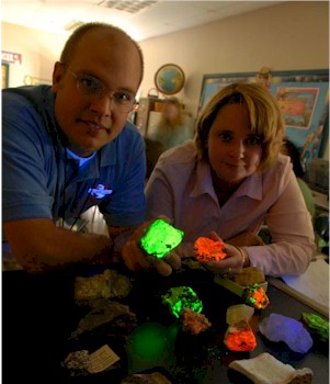
K-12 Fellow Bryan Schultz and Teacher-Partner Crystal Yates with rock samples that glow in ultraviolet light. Students did not find glowing rocks in their schoolyard soil pits, but the rocks and soil they did find provided information about the environmental history of the schoolyard.
GK-12 Fellow Bryan Schultz and teacher-partner Crystal Yates developed an inquiry-based project for science students at Northview Middle School that involved field study of campus geology and soils. Together with teacher Jayne Schultz, they wrote about their project in the journal Science Scope, published by the National Science Teachers Association. Click here for for more information and to obtain a copy of their article.
Bryan Schultz, Crystal Yates, and Jayne M. Schultz, 2008. Digging Into Inquiry-based Earth Science Research. Science Scope 32(4): 26-31. ABSTRACT: To help eighth-grade students experience the excitement of Earth science research, the authors developed an inquiry-based project in which students evaluated and cataloged their campus geology and soils. Following class discussions of rock-weathering and soil-forming processes, students worked in groups to excavate multiple soil pits in the school yard. They collected soil samples to study the characterization of soil morphology and to conduct petrographic (i.e., thin-section) and scanning electron microscope (SEM) analyses. Students gained hands-on geospatial and mathematic skills from recording compass, distance, and orientation measurements while establishing a base map for their campus research site.
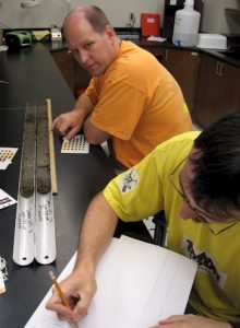
GK-12 Teacher-Partners Oscar Osorio, Crystal Yates, Jay Bachmann, and Greg Metcalf conducted field research in Great Smoky Mountains National Park with Fellow Chris Underwood in summer 2007. Their goal was to recover soil cores from several pine stands in which Faculty Advisor Henri Grissino-Mayer and other graduate students are studying tree-ring records of fire history. Back in the lab, the teachers worked with Chris to extract, dry, and carefully weigh charcoal in soil samples from different depths of the cores. Through radiocarbon dating and identification of charcoal particles, and analysis of spatial patterns in charcoal abundance, Chris can reconstruct prehistoric fires and vegetation at the sites. This information complements and extends the information from the companion tree-ring study, providing information on long-term fire history relevant to issues of park management, forest dynamics, climate history, and preColumbian human impacts.
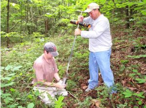
Chris Underwood (left) and Oscar Osorio using a root auger to collect soil core samples in Great Smoky Mountains National Park.
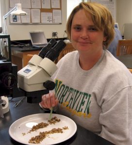
Crystal Yates isolating charcoal fragments from a soil sample collected in Great Smoky Mountains National Park.
During summer 2007, two of our GK-12 Teacher-Partners, Ann McGhee and Oscar Osario, worked with Dr. Carol Harden and a team of University of Tennessee graduate students that included GK-12 Fellow Annie Wambersie to monitor flow, bank erosion, and tributary stream particle size at 30 sites in the Little River watershed in Blount and Sevier Counties, Tennessee. The teachers gained hands-on experience measuring stream velocity and calculating flow rates, measuring rocks on the stream beds, measuring the exposures of streambank erosion pins, and helping the team take excellent field notes. Much of the study area is served by Oscar’s school (Heritage Middle School), so, in the process of contributing to scientific research, he became more familiar with the rural areas where his students live.

Ann McGhee (left) and Oscar Osario measuring the velocity of Ellejoy Creek.
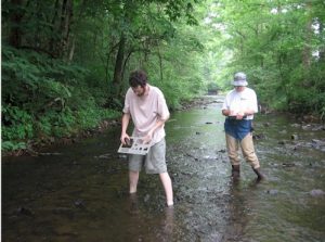
Graduate student Chris Morris (left) and Ann McGhee measuring rocks on the bed of Hesse Creek.
GK-12 Teacher-Partner Jay Bachmann worked in the lab with Faculty Advisor Dr. Linda Kah during summer 2007. Jay worked with Linda to process carbonate samples from Argentina for isotope analysis. Jay experienced the whole process, starting in the rock room, where he learned to make petrographic thin sections and polished thick sections, in the process learning to use a variety of rock saws and polishing equipment. He learned to do some petrographic analyses, and later spent a day using the cathodoluminescence (CL) microscope. After some practice he ran the CL set-up on his own: inserting rocks into the chamber, evacuating the chamber, turning on the electron gun, focusing the electron beam, taking pictures, and interpreting the luminescence of the samples. Jay also used Linda’s micro-drill press, which uses a variety of dental drill bits, to microsample representative portions of the rock for geochemical analysis. Jay’s summer research experience helped move ahead Linda’s current research on Paleozoic ocean-atmospheric evolution, and no doubt gave Jay a new perspective on rock formation and what we can learn about the past from Earth’s geologic record.
In our first international field experience for GK-12 teachers, Greg Metcalf traveled to Costa Rica with Fellow Zack Taylor and Faculty Advisor Sally Horn in summer 2007 to conduct research at Laguna Zoncho in the southern Pacific lowlands near the Panamanian border. Using a piston corer operated from a floating platform, the group recovered six sediment cores from the lake in support of Zack’s Ph.D. research on spatial patterns in pollen and isotope signatures of prehistoric agriculture in lake sediments. Following the field work, Greg joined Zack, Sally, and other students in the Laboratory of Paleoenvironmental Research at the University of Tennessee, as they opened and described the sediment cores in preparation for sampling. The Costa Rica trip was not only a great opportunity for Greg to collaborate in scientific research and learn first-hand about tropical forests, but was also his very first trip outside of the United States.
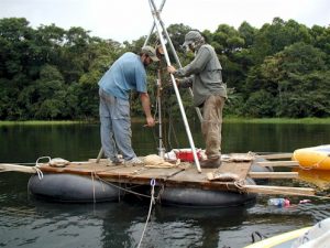
Zack Taylor (left) and Greg Metcalf using an engine hoist borrowed from an auto repair shop to extract a stuck bore.
Greg and Zack examining the Zoncho cores in the Laboratory of Paleoenvironmental Research at the University of Tennessee.
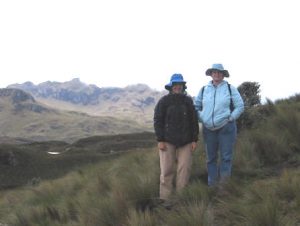
Ms. Crystal Yates, GK-12 Teacher-Partner and science teacher at Northview Middle School, accompanied University of Tennessee Professor and GK-12 Faculty Advisor Carol Harden on a research trip in the high Andes in Ecuador for two weeks in May–June, 2008. Ms. Yates joined Harden and two other geographers (Dr. Kathleen Farley and Ms. Leah Bremer of San Diego State University) as they traveled by plane, bus, truck, horse, and on foot to sites where they are studying the effects of land-use change on water and carbon content of soils in the high altitude “paramo” grasslands. Ms. Yates helped the researchers measure soil moisture and obtain soil samples at sites in grasslands, pine plantations, and native forest. She also got a first-hand view of the “behind-the-scenes” process of meeting within-country collaborators to maximize the benefits and extend the resources of the research. The 2008 field research was the first step in a larger project that will study how planting trees or changing fire regimes affects the water and carbon storage of high elevation páramo soils. The Ecuadorian research partners are anxiously awaiting the results because their water supply and energy (as hydropower) depend on the role of the grassland soils as reservoir.
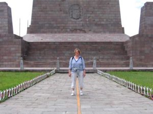
Following a final meeting with other researchers in Quito, Ecuador, Yates and Harden found a few hours to explore what it means to be at the Equator.
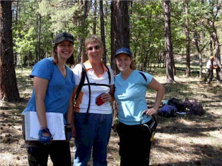
Ann McGhee (center) with Project Leader Monica Rother (left) and Field Assistant Sarah Jones (right) sampling in Cibola National Forest, New Mexico.
Ms. Ann McGhee joined a large research team from the Department of Geography that involved five graduate students and three undergraduate students, led by Faculty Advisor Dr. Henri Grissino-Mayer, that investigated the forest stand history of the Cibola National Forest and El Malpais National Monument in northwestern New Mexico. The goal of this project was to collect samples from fire-scarred logs and stumps to document the history of past fire in areas that have been heavily affected by fire exclusion caused by human alteration of fire regimes. Funded by the National Park Service, the team of scientists spent a week driving through rugged but beautiful terrain, and found four sites from which they extracted several hundred samples.
Ms. McGhee was a “natural” in this environment and her past experiences living and visiting in this type of environment prepared her for hiking across the rugged lava flows and up and down steep mountain slopes. She helped locate fire-scarred stumps, assisted in the collection of cross sections from these stumps, recorded information using a GPS unit, and helped prepare the samples for transport back to Knoxville. She also proved herself an excellent camp cook! She also got to visit El Morro National Monument, Bandera Ice Cave, and Bandera Crater.
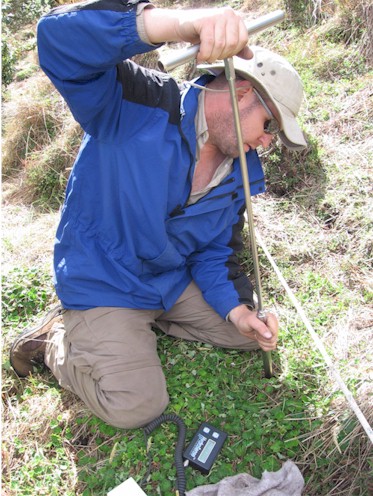
Mr. Metcalf, extracts a sample of soil along a grassland transect. The density of the soil and mass of water it contains will be determined in the lab and compared to the moisture content measured in the field
Mr. Gregory Metcalf, GK-12 Teacher-Partner and science teacher at Heritage Middle School in Blount County, Tennessee, joined an National Science Foundation-supported research team in the Ecuadorian Andes in July 2009. The team was co-led by UT Professor and GK-12 Faculty Advisor, Carol Harden, and Dr. Kathleen Farley, a geography professor at San Diego State University. The goal of the research is to learn more about how ways in which people change the vegetation may change the physical and chemical characteristics of a special group of high mountain Andean soils that act as a reservoir for water and carbon across the northern Andes. The research will produce new knowledge about high altitude landscape processes and document the consequences of trade-offs that occur when governments and other organizations try to protect and improve the environmental services of carbon sequestration and water regulation.
Mr. Metcalf quickly became an integral member of the field team. He helped dig pits in the soil, used a GPS (global positioning system) to document the location of study transects, and became quite skilled at measuring instantaneous soil moisture along soil transects and extracting precisely cored soil samples for further analysis back in the U.S. As this was the first field campaign of a 2 ½ year project, Mr. Metcalf will continue to learn about the scientific outcomes of the project from his teammates for some time to come.